Surveying, a fundamental practice in the field of civil engineering and land management, plays a crucial role in various aspects of construction, development, and planning. From mapping terrains to ensuring precise measurements, surveying serves numerous purposes that contribute to the successful execution of projects. In this article, we’ll delve into the diverse applications of surveying, highlighting its significance and impact across different industries.
Introduction to Surveying
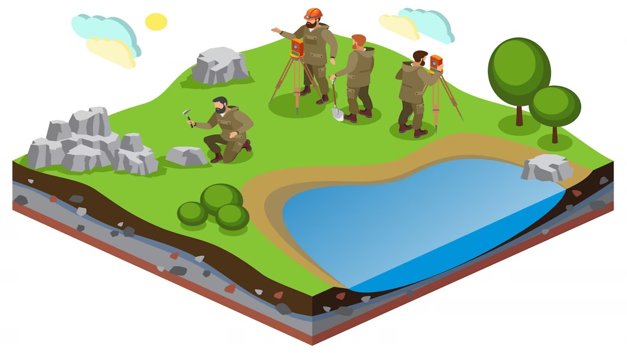
Surveying is the science of accurately measuring and mapping the Earth’s surface, encompassing both the natural and built environments. It employs various techniques, tools, and technologies to gather data that aid in making informed decisions. Let’s explore the diverse applications of surveying in different domains.
Types of Surveying
Land Surveying: This type involves measuring and mapping land boundaries, elevations, and features. It’s used in property transactions, land development, and legal purposes.
Construction Surveying: Used in the construction industry, this type ensures precise positioning of structures, utilities, and roads according to design plans.
Topographic Surveying: Focuses on mapping the natural and man-made features of a landscape, important for urban planning, engineering, and environmental assessments.
Geodetic Surveying: Deals with large-scale measurements across the Earth’s surface, taking into account the curvature of the Earth. It’s used for mapping on a global scale and in satellite navigation systems.
Hydrographic Surveying: Concentrates on mapping underwater terrains, vital for navigation, maritime construction, and resource exploration.
Aerial Surveying: Utilizes aerial photography or remote sensing technology to capture data from above, used for large-scale mapping and monitoring.
Cadastral Surveying: Involves establishing and managing property boundaries, particularly important for property ownership and taxation.
Engineering Surveying: Aids in construction projects by providing precise measurements for designing, setting out, and monitoring structures.
Mining Surveying: Applied in the mining industry to create accurate maps of mining sites, assess resources, and ensure safe extraction.
Archaeological Surveying: Used in archaeological research to map and document historical sites and artifacts.
GIS Surveying: Geographic Information Systems (GIS) combine various surveying data to create comprehensive spatial databases for analysis and decision-making.
Surveying is crucial in “Land Development and Planning,” aiding precise mapping and informed decision-making. During land assessment, surveyors collect data on topography, soil composition, and existing features. This information guides planners in determining suitable land use and infrastructure placement. Surveying’s role extends to boundary identification, ensuring clear property demarcations. Overall, surveying empowers efficient land utilization, contributing to well-organized and sustainable development projects. Survey data guides the layout of roads, buildings, and other infrastructure, ensuring efficient land utilization and adherence to zoning regulations.
Construction Projects
Surveying is integral to construction projects, offering precise measurements and mapping critical for successful execution. During initial stages, surveyors establish accurate site boundaries and assess topography. Their data informs design, helping architects and engineers create precise plans. Throughout construction, surveyors set control points, ensuring accurate positioning of structures and elements. They play a crucial role in ensuring that buildings adhere to architectural guidelines, producing safe and useful structures. In essence, surveying guarantees precision, minimizing errors, and enhancing the overall quality of construction projects.
Environmental Monitoring
Surveying aids in monitoring and assessing environmental changes over time. By conducting periodic surveys, experts can track erosion, shifts in water bodies, and changes in vegetation, helping to develop strategies for environmental preservation.
Infrastructure Development
Survey plays a pivotal role in infrastructure development by providing precise measurements and accurate mapping for various projects. During the preliminary site assessment, surveyors gather data on topography and soil composition, aiding in project feasibility determination. In the design phase, survey data guides engineers in creating layouts and alignments for structures and utilities. Throughout construction, surveyors ensure that built elements match the intended design. Beyond completion, they monitor infrastructure integrity, recommend maintenance, and contribute to environmental impact assessments. Overall, surveying’s data-driven approach ensures efficient, safe, and sustainable infrastructure development.
Survey plays a pivotal role in “Mapping and Geographic Information Systems (GIS),” providing accurate data for comprehensive spatial analysis. Surveyors collect precise measurements and coordinates that form the foundation of detailed maps. This data integration into GIS enables effective urban planning, resource management, and disaster response. Survey contribution enhances the accuracy and reliability of spatial information, empowering decision-makers to optimize land use, infrastructure development, and environmental conservation.
Survey forms the foundation of accurate mapping and Geographic Information Systems (GIS). GIS integrates spatial data to create detailed maps used in urban planning, disaster response, and resource management.
Archaeological Investigations
The survey is essential in Archaeological Investigations, offering precise mapping and site analysis. Surveyors create detailed site maps, pinpointing artifact locations and excavation areas. By capturing accurate topographical data, they aid archaeologists in understanding historical landscapes and contextualizing findings. The survey role extends to documenting site dimensions and features, providing vital information for research, and preserving valuable historical insights.
Disaster Management
During natural disasters like earthquakes or floods, surveying facilitates rapid assessment of damages and helps emergency response teams strategize relief efforts effectively.
Real Estate and Property Management
Survey plays a critical role in Real Estate and Property Management, ensuring transparency and accuracy in transactions. Surveyors establish precise property boundaries, resolving potential disputes and providing clear legal descriptions. Their data aids in assessing property values and evaluating land for development potential. In property management, survey assists in planning improvements and expansions while adhering to zoning regulations. Overall, surveying’s contribution enhances the integrity of real estate transactions and effective property management.
Mining and Mineral Exploration
Surveyors assist in mineral exploration by mapping potential mining sites and evaluating the viability of extraction. Accurate measurements aid in optimizing resource extraction processes.
Agricultural Planning
Survey aids in determining land suitability for agriculture, optimal irrigation layouts, and contour mapping to prevent soil erosion. It contributes to sustainable farming practices.
Transportation Projects
From designing road networks to planning railway systems, the survey supports the development of efficient transportation infrastructure, enhancing connectivity and mobility.
The survey is vital in Transportation Projects, guiding the design and construction of efficient and safe networks. Surveyors collect precise data on land contours, existing structures, and environmental considerations. This information informs the layout of roads, highways, and railways, optimizing alignment and minimizing environmental impact. During construction, surveyors ensure the accurate placement of infrastructure elements. Their role contributes to seamless transportation systems, enhancing connectivity and mobility for communities.
Hydrographic Surveying
The hydrographic survey focuses on mapping underwater terrains, essential for maritime navigation, port development, and offshore resource exploration.
Utilities and Communication Networks
Survey plays a role in laying utility lines, such as water, gas, and electricity, and establishing communication networks like fiber optics, ensuring seamless services for communities.
In conclusion, survey serves as a cornerstone in various industries, shaping the way we interact with our surroundings. Its applications span from urban planning and construction to environmental conservation and disaster management. As technology continues to advance, the role of surveying will only become more critical in ensuring precision, efficiency, and sustainable development.
Frequently Asked Questions (FAQs)
How does a survey benefit construction projects?
The survey provides essential data for precise construction, ensuring structures are built accurately and following design specifications.
Why is a survey crucial in real estate?
The survey defines property boundaries, resolves disputes, and ensures transparency in property transactions.
What is the significance of a hydrographic survey?